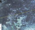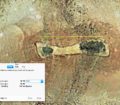


Ruins in the vicinity of the ancient city of Eridu. One of the very first urban settlements in Sumeria, dating to the 5th century BC, one of the oldest city centers in the world. Canals can be seen to the North of the ruins and the whole area is enclosed by canals.
GPS: 30.825796°,45.994750°
loading map - please wait...
![]() Eridu Ancient Sumerian City
Eridu Ancient Sumerian City
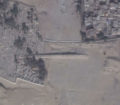
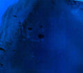
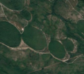
Hill top ruins so ancient the hill almost looks entirely natural from satellite imagery:
Eridu Hill Top Ruins
loading map - please wait...